How UAS Mapping Supports Better Construction Progress Documentation
This blog explains how UAS mapping can help construction teams document site progress more clearly and consistently. It focuses on using aerial data, orthomosaic mapping, and visual reporting to support communication, progress tracking, and site records across active construction projects. The article is written for contractors, developers, project managers, material yards, utilities, and commercial property stakeholders who need a reliable way to see changing site conditions from above. It positions TriStar Aerial Solutions as a professional aerial data collection partner while carefully avoiding survey, engineering, or inspection claims.
6/13/20262 min read
Construction sites change quickly. Earthwork moves, materials arrive, access routes shift, and completed work can be covered or altered before every stakeholder has seen it. When decisions depend on current site conditions, clear documentation matters.
UAS mapping gives contractors, developers, and project stakeholders a practical way to capture aerial data across a site and turn it into useful visual records.
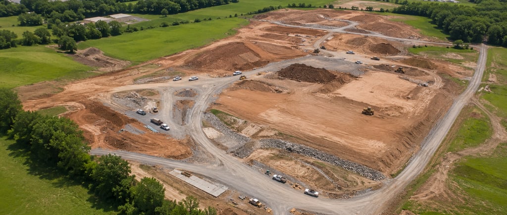
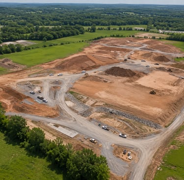
A UAS mapping flight can collect overlapping aerial imagery that supports orthomosaic mapping, site documentation, elevation-change review, and progress comparison over time. Instead of relying only on ground photos or written updates, teams can review a broader visual record of the project from above.
For construction teams, this can help with:
Tracking visible progress across large or active sites
Documenting work areas before conditions change
Supporting communication between field teams, owners, and project managers
Comparing current site conditions with previous documentation
Maintaining a visual record for meetings, planning, and reporting
UAS-derived mapping is especially useful when site access is limited, terrain is uneven, or stakeholders need a clear overview without walking the entire project. Aerial documentation can show haul roads, staging areas, stockpiles, drainage features, cleared areas, and general construction progress in one organized view.
At TriStar Aerial Solutions, our role is to collect accurate aerial data and provide clear visual reporting support. We help project teams document site conditions with disciplined UAS operations, structured data collection, and professional deliverables that support safer, smarter, faster decision-making.
It is important to understand the role of this data. UAS mapping can support construction documentation and project communication, but it is not a replacement for licensed survey, engineering, or inspection services unless performed under the proper responsible charge. Used correctly, it becomes a valuable tool in the broader project documentation process.
For contractors, developers, material yards, utilities, and commercial property stakeholders, consistent aerial documentation can reduce uncertainty and improve visibility across the life of a project.
TriStar Aerial Solutions provides precision aerial intelligence for teams that need a clearer view of what is happening on site.
Need reliable aerial documentation for your next project? Contact TriStar Aerial Solutions to discuss UAS mapping and construction progress documentation for your site.
#UASMapping #ConstructionDocumentation #AerialData #DroneMapping #MiddleTennessee #TriStarAerialSolutions