Our Equipment - Your Solutions
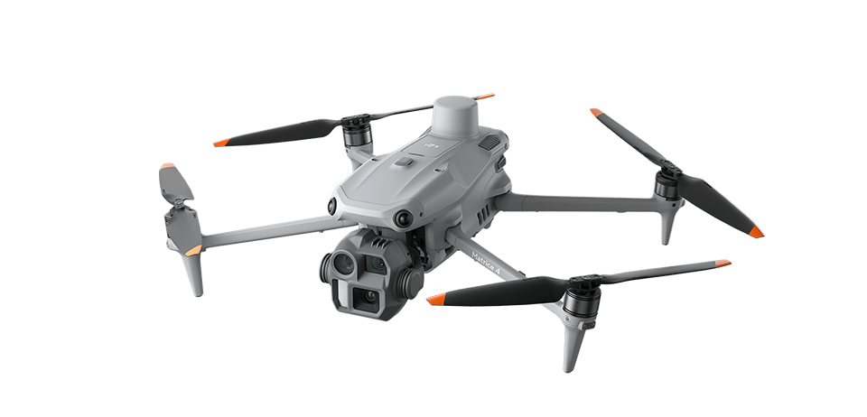
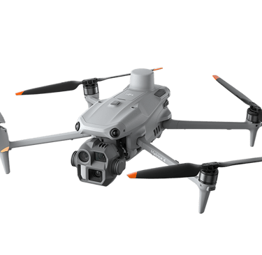
DJI Matrice 4E
DJI Matrice 4E is a compact enterprise UAS platform built for efficient mapping, site documentation, and geospatial data capture. It features a 4/3-inch 20 MP wide camera, 48 MP medium tele camera, 48 MP tele camera, mechanical shutter, laser range finder, and RTK capability, making it well-suited for orthomosaic capture, surface modeling, progress tracking, and volumetric workflows. DJI also lists up to 49 minutes of max flight time in no-wind conditions, supporting efficient coverage on larger sites.
For TriStar Aerial Solutions, this platform strengthens our ability to deliver faster site intelligence, clearer documentation, and more efficient field capture for construction, development, and material management clients. High-precision deliverables still require GCP-constrained data when Class A accuracy is required.
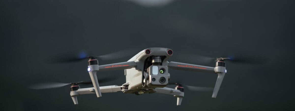
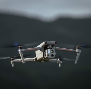
Autel Evo Max 4T
Autel EVO Max 4T is an enterprise UAS platform built for demanding inspection, public-safety-style overwatch, thermal assessment, and complex site awareness missions. Autel lists an integrated wide camera, 48 MP zoom camera with 10x optical zoom and up to 160x hybrid zoom, thermal camera, laser rangefinder, 720-degree obstacle avoidance, mesh networking capability, and up to 42 minutes of max flight time.
For TriStar Aerial Solutions, this platform adds value where clients need more than standard visual imagery. It supports safer inspection stand-off, improved situational awareness, thermal identification, and stronger documentation in environments where detail, reach, and operational resilience matter. Where precision deliverables are required, survey-grade outputs still depend on proper control and workflow discipline.
DJI Air 3S
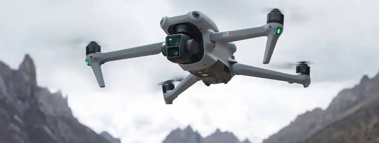
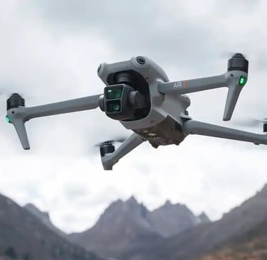
DJI Air 3S is a compact dual-camera UAS platform well-suited for high-quality visual documentation, marketing imagery, site overviews, and general project support. DJI lists a 1-inch 50 MP primary camera, a 70 mm medium tele camera with 48 MP resolution, up to 14 stops of dynamic range, and advanced obstacle sensing in a portable form factor.
For TriStar Aerial Solutions, this platform adds value by providing efficient capture of clean, professional visuals for progress documentation, property and site presentation, stakeholder updates, and contextual overviews where mobility and speed matter. It is an effective solution for clients who need strong imagery and dependable field coverage without the heavier enterprise footprint of a larger platform.
Emlid Reach RS2+ GNSS Base
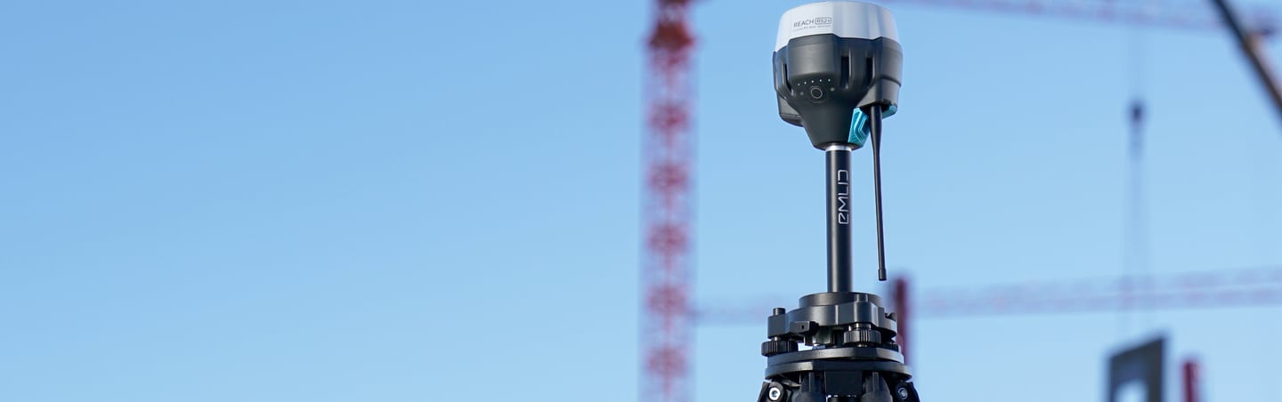
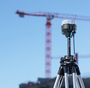
The Emlid Reach RS2+ serves as our primary base and high-precision field receiver for control establishment, RTK support, and PPK-ready data collection. It gives us a stable geodetic foundation for GCP-constrained mapping, topographic control, and repeatable survey workflows. In practical terms, that means stronger positional confidence, cleaner control networks, and a dependable Data Safety Net for critical missions where defensible results matter.
Emlid Reach RX Rover

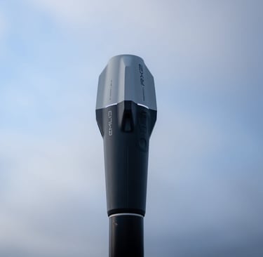
The Emlid Reach RX is our field rover for fast, efficient ground control and checkpoint collection. It allows us to capture precise point data in the field with a streamlined workflow that supports construction layout verification, topographic support, and photogrammetry control. The value to clients is straightforward: faster field collection, stronger quality control, and more reliable ground truth behind every high-precision deliverable.